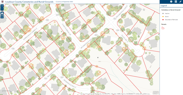
James French, husband of Sarah Sallie Curtis French, was the first member of the French family to live at Poplar Grove Farm. James had come from a home named Oak Hill1 near Arcola, Virginia in Loudon County. Near the home was a family cemetery that is currently called the French Bradshaw cemetery. The French Bradshaw cemetery was registered by the family in 2002 and is noted in Loudon County survey of cemeteries in 2020 and also in the Loudon County Interactive Map of Cemeteries and Burial Grounds. The French Bradshaw Cemetery was also mentioned in a local news article because of its awkward location2 in Loudon Valley Estates.

2002 Descendent Visit3 to the French Bradshaw Cemetery
On July 12, 2002, the following descendants of WILLIAM LEWIS FRENCH (1775-1839) and ANNA GUY ISEMONGER FRENCH (1776-1852) visited their burial site:
Lois Grubb Ward
Sally Lou Fitzhugh
Betty Pilcher Brown
Wilburn Davis Moore, Jr.
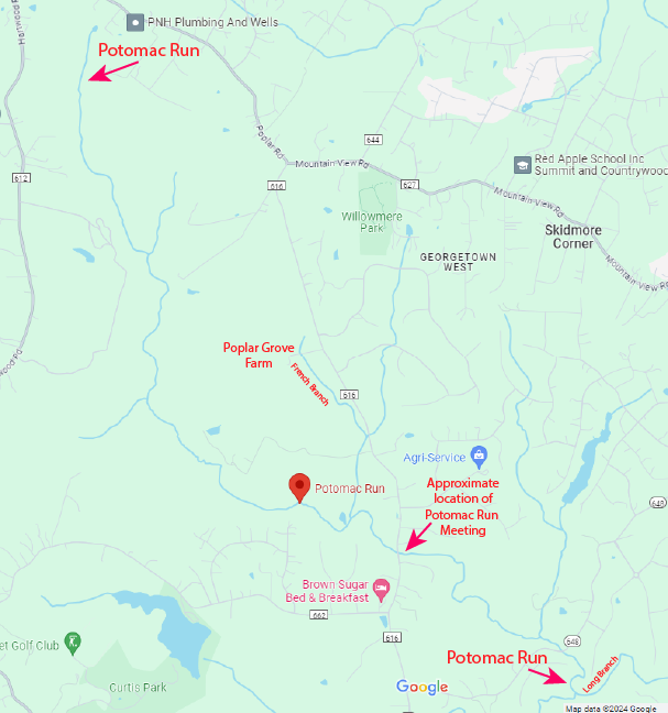
Carol Anne MooreThe FRENCH/BRADSHAW CEMETERY is located in Southeastern Loudoun County, Virginia…..by my estimate about 8 1/3 miles South of the Potomac River and about 5 ½ miles West of the Loudoun/Fairfax county lines, Northwest of Washington, D.C.
I suspect for any future family members who search out this ancestral graveyard, it can be most familiarly described as being less than 2 miles Westward from the northern most boundary of DULLES INTERNATIONAL AIRPORT. Planes landing and taking off can easily be seen from the graveyard. (In fact, it would be easy for a family member with a layover in this airport to rent a car and visit this cemetery.)
The William Lewis French/Anna Guy Isemonger French burial spot contains 3 engraved tombstones–A.G. French (“our grandmother”), and Lydia I. Bradshaw (Anna’s daughter) and Walter N. Bradshaw (her son-in-law). For this reason, I refer to this cemetery as THE FRENCH/BRADSHAW CEMETERY.
There are clearly 4 other graves marked at the head and foot by stones, and possibly 5 other graves also marked by stones. A copy of my sketch of these stones is attached to this note.
I believe that William Lewis French is lying next to his wife, A.G. French, and that his grave is marked by 2 stones. All the graves are oriented in an East-West direction.
I believe it VERY fortunate that we visited the French Bradshaw Cemetery when we did. If we had not visited when we did, we probably would have NEVER been able to find this cemetery later. In July 2002, this area is under construction, with massive bull dozers and earth moving equipment everywhere over more than 200 acres. Expensive new homes are to be constructed in this area.
The subdivision is to be called LOUDOUN VALLEY ESTATES. Amazingly, we were able to speak with a very kind construction foreman, who showed us the plans for this subdivision. At this time, we expect the French/Bradshaw Cemetery to end up at the SE corner of the first large section of this subdivision. According to the foreman’s plans, the French Bradshaw Cemetery will be immediately East of the intersection of streets to be built named LUCKETT BRIDGE CIRCLE and MECHANICSVILLE GLEN ST. I assume there will be one house site between this intersection and the cemetery. There appears to be a newly constructed 3 foot high dirt berm on the North and West sides of the French/Bradshaw Cemetery to separate it from the subdivision.
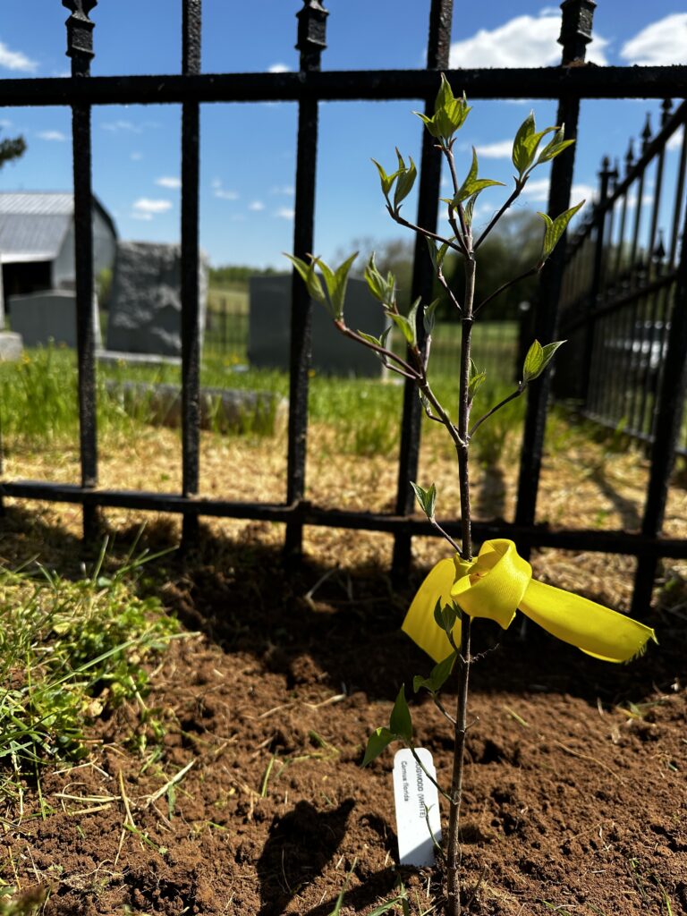
There are many large trees growing in the cemetery, and it is presently surrounded by a dilapidated barb wire fence enclosing an area of about ¼ acre.
After we found the cemetery (which is a story of TRULY serendipitous luck…finding a archeologist there and later a water truck driver who just happened to know where the cemetery was etc), we went to the Loudoun County Library at Leesburg. We found that this cemetery was not recorded in any of their records, but they assured us that this cemetery would be visited and recorded in the county library very soon.
For those who may want to visit this ancestral cemetery, I leave the following directions:
1) FROM DULLES INTERNATIONAL AIRPORT:
From the East (main) entrance road into the airport (which I believe is a toll road), go eastward from the airport to the first intersection (Sully Rd, Hwy 28) and turn North. Travel Northward slightly less than 3 miles to the village of Sterling, then turn Westward on Rd 625 (Waxpool Rd), travel slightly less than 2 miles to a point where this road splits to the left, then continue on Rd 625 Westward 1 1/2 miles to Farmwell community where 4 roads intersect, then turn SW on Rd 772 (Ryan Rd), travel SSW about 1 3/4 miles to an almost 90 degree turn in the road. At this sharp turn, we believe will ultimately be the entrance to the LOUDOUN VALLEY ESTATES SUBDIVISION, turn into this subdivision and go Eastward until you find the intersection of LUCKETT BRIDGE CIRCLE and MECHANICSVILLE GLEN ST.4, which should be on the eastern side of the subdivision.
When Rd 772 (Ryan Rd) completes the sharp turn, just past the entrance to this subdivision, the road goes due East and West, so one could go past the subdivision entrance and past the turn and down the road a few hundred feet, then turn around and the driver would be looking due East. From the curve at the edge of the road, we stepped about 2000 feet due East to the cemetery, remembering of course, right now this area was bare dirt with no houses yet.
2) FROM THE SOUTH
Travel on U.S. Highway 50 in Loudoun County (between U.S. Highways 15 and 29) to the ARCOLA exit (Rd 659). Travel Northward to the VERY small village of Arcola, At Arcola turn left, travel about ¼ mile, then turn right (still on Rd 659), then go Northward about 2 ¼ miles to RYAN RD (Rd 772), turn Eastward (the right) on Rd 772 and drive for 1 ¼ miles. At this point, the road makes an almost 90 degree turn to the North. The cemetery is located about 2000 feet due East of this turn. I think that if the road had continued due East instead of turning, the road would have gone by the cemetery. However, at this turn should be the entrance to LOUDOUN VALLEY ESTATES SUBDIVISION. If so, go into this subdivision heading Eastward to the intersection of LUCKETT BRIDGE CIRCLE and MECHANICSVILLE GLEN ST5 at the eastern edge of this subdivision.The French/Bradshaw Cemetery is located due East6 of this intersection, though there may be a house lot between the intersection and the cemetery.
I HOPE YOU VISIT IT!
Davis Moore PAF Notes for William L French
2005 Descendants Visit to the French Bradshaw Cemetery
Visited again on June 6, 2005 by Sally Lou Fitzhugh, Betty Brown, and Nancy Cox. Two large and expensive ($700,000) homes are being constructed next to the French Bradshaw cemetery.
Davis Moore PAF Notes for William L French
Improper records at Loudon County for the French Bradshaw Cemetery
For reasons that are unclear, Loudon county has not listed any of the marked graves in its database for the French Bradshaw Cemetery. The cemetery is not located on Google Maps, and it’s not even listed at Find a Grave. For these reasons, we plan to take a trip to Loudon to clean the headstones, photograph them, document the site, and turn these records over to Loudon County and Find A Grave. When that is complete, we will list the location of the graveyard on Google Maps future family members can locate the graveyard.
- This is not the Oak Hill manor where James Monroe lived for 22 years, which is also in Loudon County. ↩︎
- Note that the cemetery was located first, and any awkwardness was caused by developers who chose to place new build homes close to clearly marked graves, not that the graveyard is inconveniently located for the homes as noted in the article. ↩︎
- In 2002, Sally Lou Fitzhugh discovered that a subdivision was being built near the location of the French Bradshaw Cemetery. Several descendants decided to go see the development to ensure the cemetery was being preserved. Following is the record Davis Moore wrote of that visit: ↩︎
- Note that Luckett’s Bridge Circle is a … circle, and there are two intersections with Mechanicsville Glen Street. ↩︎
- Note that Luckett’s Bridge Circle is a … circle, and there are two intersections with Mechanicsville Glen Street. ↩︎
- SSE of the intersection ↩︎